New York Maps Home > New York Map Collection > Manhattan Lower 1920, Historical Map
Printable Map of Manhattan Lower 1920, Historical
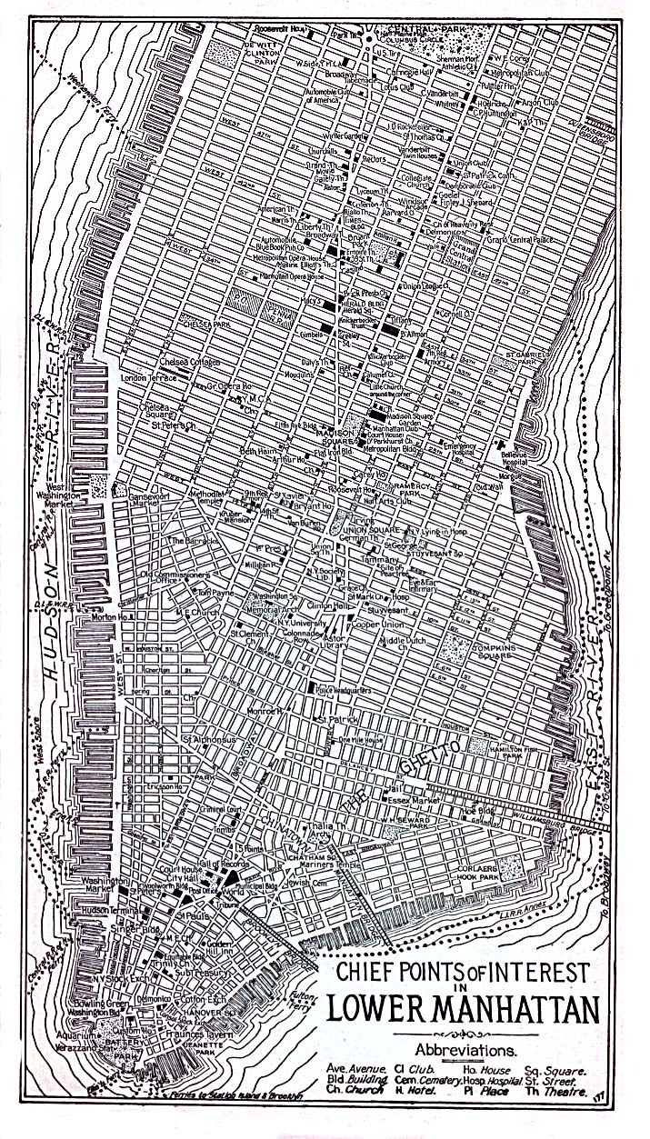
On top you have a basic projection showcasing the geography of this area with a simple variety of elements.
You have permission to download this web page and utilize it in your research. Giving credit to this webpage would be awesome.
Supposing you require aid retrieving a map, a different kind of map, or require a great tailor-made concoction, please email us.
Procure proper customized maps from us. Our custom maps provide a wide mixture of features, for instance: highways, legend, GPS coordinates, bays, indian reserves, sea features, glaciers, or rivers, etc. Map types range from topo to tourism, travel to research, census blocks to urban growth areas.
Great maps are correct, current, and not obsolete. Distinguished map design by YellowMaps.
To procure actual maps that get delivered in the mail to your home, for instance recreation atlases, state maps, or maps for canoeing, do not hesitate to marvel at the cartographic delights in our map store It contains tens of thousands map items.
Looking for historical maps, or large-format map prints? Ask us.
Back to New York map collection