New York Maps Home > New York Map Collection > Manhattan Upper 1920, Historical Map
Printable Map of Manhattan Upper 1920, Historical
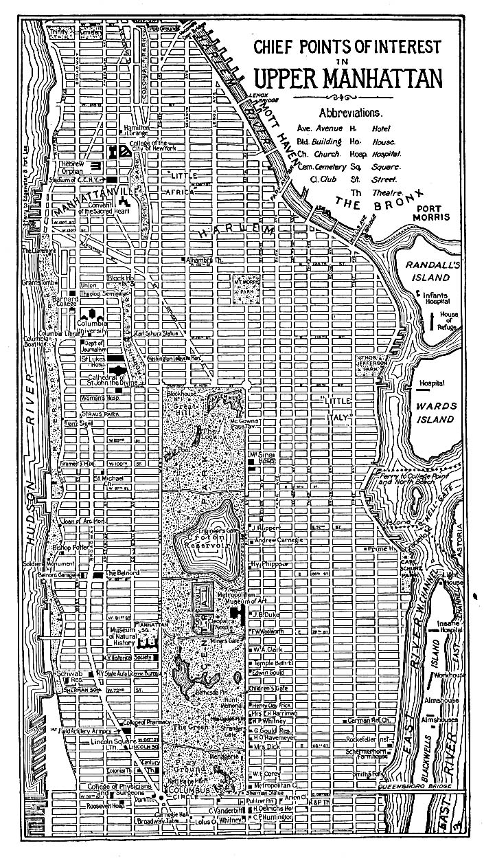
The image above is a simple projection offering the layout of this locality with a basic combination of details.
You have permission to print this web page and take advantage of it in your work. Citing this page is considerate and well thought of.
Supposing you desire aid acquiring a map, a different kind of map, or desire a first-class custom production, you can get in touch with us.
Purchase good tailor-made maps from us. A tailor-made product produced by us encompass a useful diversity of details, like: avenues, scale bar, UTM coordinates, bays, indian reserves, valleys, hamlets, or provinces, etc. Map types go from urban to locator, static to dynamic, state or province to urban growth areas.
First-Class maps are detailed, all-encompassing, and not misleading. Fine map-making by YellowMaps.
To purchase printed maps or charts, like recreation atlases, maps of continents, or topographic maps, please pay a visit to our map store We carry more than 100,000 map items.
We make and retail maps. And we love it.
Back to New York map collection